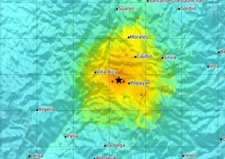
7.6 Magnitude Earthquake Strikes Panama; Tremors Felt in Capital, Tsunami Threat Issued

A powerful magnitude 7.6 earthquake struck Panama on Friday, October 9, shaking buildings in the capital and prompting people to evacuate into the streets, according to the United States Geological Survey (USGS).
The earthquake occurred near the southern part of the Central American country, with its epicentre located approximately 10 kilometres southwest of Pitaloza Arriba, a remote community in Panama. The quake was recorded at a depth of around 10 kilometres.
Tremors were felt in Panama City, where residents reportedly left buildings and gathered outdoors as they waited for further information about the earthquake's impact.
The incident prompted concerns about possible damage, aftershocks and tsunami risks. The situation remained developing as initial reports emerged.
USGS Revises Earthquake Magnitude
The USGS initially reported the earthquake at magnitude 8.0 before revising the measurement to 7.6.
Such revisions can occur as seismologists analyse additional seismic data after a major earthquake. The updated measurement provides a more refined estimate of the event's magnitude.
The earthquake's shallow depth was another important factor, as shallow earthquakes can produce strong shaking near their epicentres. However, the actual impact depends on factors including distance, local geology, building construction and population exposure.
Tremors Shake Panama City
Panama City, the country's capital and largest urban centre, was among the places where the tremors were felt.
Residents reportedly moved outdoors as buildings shook. Evacuations were prompted amid concerns about the safety of structures following the powerful earthquake.
Authorities and emergency responders faced the task of assessing the situation and determining whether the quake had caused significant damage.
At the time of the initial reports, comprehensive information about casualties and structural damage was not available. The full extent of the impact therefore remained unclear.
Tsunami Threat Raises Coastal Concerns
The US Tsunami Warning System issued a tsunami threat following the earthquake. The alert raised concerns for potentially affected coastal areas and highlighted the need for residents to follow official instructions.
A tsunami threat does not automatically mean that damaging waves will reach every coastline. The risk depends on the earthquake's location, the movement of the seabed and local coastal conditions.
Residents in areas covered by official warnings should follow instructions from local authorities and emergency management agencies, including evacuation guidance where issued.
Why Panama Experiences Earthquakes
Panama lies in a geologically active part of Central America, where the interaction of tectonic plates and regional fault systems can generate earthquakes.
Earthquakes occur when stress accumulated in the Earth's crust is released along faults. The resulting seismic waves travel through the ground and can cause shaking over a wide area.
The magnitude of an earthquake measures the energy released at its source, while the intensity of shaking describes how strongly it is felt at particular locations. A large earthquake can therefore produce different levels of shaking depending on distance and local ground conditions.
Situation Remains Under Assessment
The magnitude 7.6 earthquake put Panama on alert as authorities and residents awaited further information about its consequences.
Officials and monitoring agencies continued to assess the situation, including potential damage and tsunami-related risks. Information may change as additional observations and official updates become available.